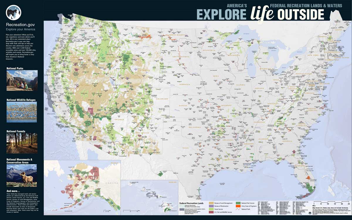
Want to see a bird’s eye view of where to hunt, fish, and play on public lands in the United States? A new federal recreation lands poster that shows the overall amount and location of public lands is now available and offers just that.
The map was created thanks to the data provided by the U.S. Geological Survey. It highlights the recreation lands and waters managed by seven different federal agencies—National Park Service, Forest Service, U.S. Fish and Wildlife Service, Bureau of Land Management, Army Corps of Engineers, Bureau of Reclamation, and the National Oceanic and Atmospheric Administration.

The backside of the poster shows recreation information.
Go here to see and/or download a higher-resolution map.
(Image source: ProtectedLands.net)